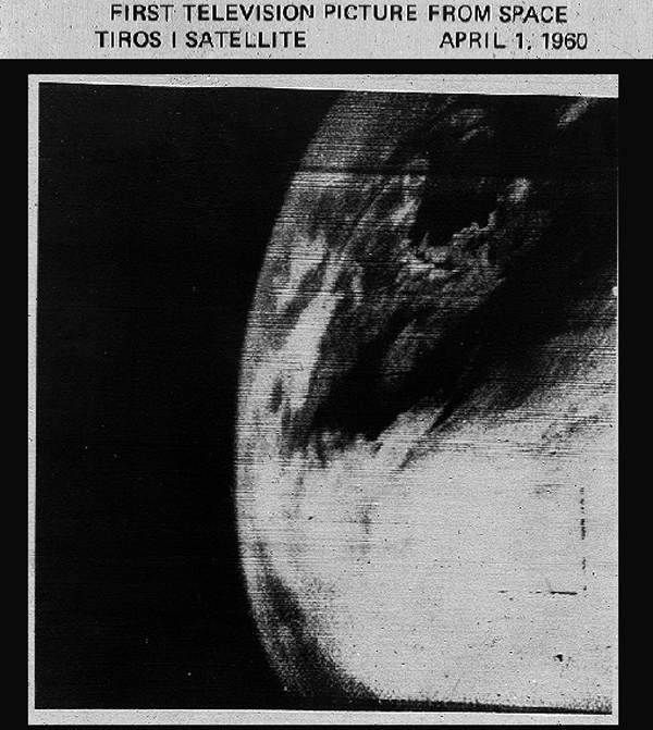

This image of clear skies over Nova Scotia and the coast of Maine has been widely presented in recent years as the first TV picture from space, taken a little over fifty years ago by the dedicated meteorological satellite TIROS 1 on the day of its launch, 1 April 1960. But comparison with corresponding weather maps produced from the ERA-40 reanalysis has led to confirmation that whilst this image is one of the early pictures from TIROS 1, it is certainly not the first.
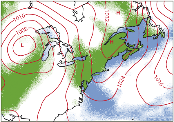
Reanalysis feeds weather observations collected over past decades into a modern data assimilation system. ERA-40 reanalyses produced at ECMWF have been used to examine the period when TIROS 1 was launched. An article published this month in the magazine Weather (65, 211-212) concludes that the image shown here is in fact a better fit to the reanalysis for 1800 UTC on 2 April, following clearance of cloud that had obscured Nova Scotia and the coast of Maine for some 24 hours following launch.

In a response, Mr George Anderson has confirmed that following examination by NASA of its original records, the picture in question was indeed taken on 2 April, at 1608UTC (Weather, 65, 212-213). The first picture was actually taken at 1331 UTC on 1 April, about two hours after launch. Rather disappointingly perhaps, it shows a largely featureless cloud-covered disc, although as the satellite was viewing much the same part of the world at the time, the picture is at least consistent with the corresponding ERA-40 analysis!

The ERA-40 product closest in time to 1608UTC on 2 April 1960, when the mis-labelled picture is now known to have been taken. The three-hour forecast of surface pressure and cloud cover valid at 1500UTC is shown
This episode illustrates the power of the reanalysis technique in providing high-quality analyses that can be used for a wide variety of purposes – and shows how some of the earliest ever weather-satellite pictures can still be used to validate the capabilities of today’s data assimilation systems.
