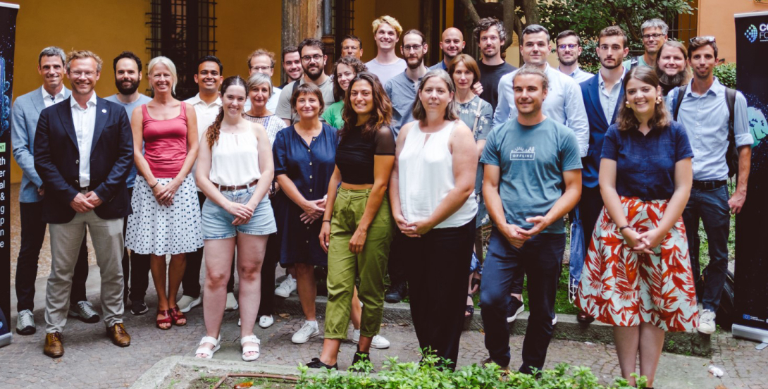
Code for Earth, an ECMWF-run innovation and partnership programme, fosters collaboration and supports advancements in weather and climate research, including in the Copernicus programme and the Destination Earth (DestinE) initiative, which are both EU-funded. Since its first edition in 2018, when it was called the Summer of Weather Code, the programme has brought together talented individuals and developer teams with experienced mentors from ECMWF to work on cutting-edge projects covering a wide range of topics. This year, ten developer teams participated in Code for Earth.

How it works
Each summer, several individuals and developer teams from different backgrounds test, explore and/or develop open-source software solutions supported by ECMWF’s mentors. Each team receives a €5,000 stipend after completion. Their projects tackle topics such as data science in weather-, climate- and atmosphere-related challenges, including visualisation, machine learning/artificial intelligence, user support tools and data analysis. By encouraging multidisciplinary collaboration and embracing open-source principles, Code for Earth facilitates the development of cutting-edge solutions and advancements in Earth system sciences.
Since its start, the programme has produced 35+ open-source software developments highly beneficial to activities at ECMWF and in its Member and Co-operating States. The programme has partnered with Copernicus, Destination Earth and two cloud initiatives: the European Weather Cloud, run by ECMWF and EUMETSAT, and the EU‑funded Copernicus Data and Information Access Service WEkEO, implemented by ECMWF, EUMETSAT, Mercator Ocean and the European Environment Agency.
Voices on Code for Earth from mentors
“It is one of the few programmes that bridges the gap between computer science and climate science and enables young people to realise their ideas in this field.”
“It’s a great programme to get people involved in small research projects!”
2023 results
This year, ten selected dynamic and enthusiastic developer teams contributed their expertise and problem-solving skills to address real-world challenges. They were supported by mentors from ECMWF and partner organisations who are world experts in their field. ECMWF, in turn, could collaborate with motivated, innovative external teams who bring different skill sets and fresh perspectives to exciting challenges.
- DeepR: Deep Learning for High-Resolution Reanalysis Data – DeepR used deep learning techniques, including U‑Net, conditional GAN, and diffusion models, to generate regional reanalysis data by downscaling global data from ERA5. A validation framework was established to ensure an accurate representation of physical processes.
- Atmospheric Composition Dataset Explorer: API for Atmospheric Composition Diagnostics – This project developed an application programming interface (API) and an application to automate the creation of time series, Hovmöller, and geospatial plots using the Atmosphere Data Store of the Copernicus Atmosphere Monitoring Service (CAMS) run by ECMWF. It facilitated data retrieval, homogenisation, and visualisation of CAMS datasets.
- Benchmarking Surface Heat Fluxes: Validation of Land Surface Variables – The LANDVER validation package was expanded to include validation of latent and sensible surface heat fluxes against Eddy-Covariance measurements. This tool provided insights into the impact of soil moisture stress on surface heat fluxes and the functionality of ECMWF's ECLand.
- Compression of Geospatial Data: Improved Compression Techniques for Diverse Datasets – This project refined the xbitinfo compression technique to account for varying information densities in datasets, leading to more efficient compression.
- ChatECMWF: Conversational Search Engine for ECMWF Data – Using natural language processing and models like ChatGPT, ChatECMWF was developed to help users access ECMWF's weather data through natural language queries.
- Fire Forecasting: Wildfire Prediction with Machine Learning – By utilising fire data from ECMWF’s Global Fire Assimilation System (GFAS) and meteorological forecasts, a machine-learning framework was developed for European wildfire forecasting, aiming for integration into ECMWF's operational pipeline.
- TropiDash: Dashboard for Tropical Cyclone Hazards – TropiDash provided a platform on Jupyter Notebook to visualise key meteorological parameters related to tropical cyclones, aiding hazard comprehension.
- Sketchbook Earth: Accessible Climate Intelligence Reports – Moving away from traditional ECMWF tools, Sketchbook Earth used Jupyter notebooks and the Copernicus Climate Data Store (CDS) to present climate data more visually.
- TesseRugged: Enhancing Reanalysis Data's Spatial Resolution – TesseRugged worked on improving the spatial resolution of global reanalysis datasets, such as ERA5, through model output strategies and deep learning for downscaling.
- Diffusion Models on WeatherBench: Machine Learning for Weather Forecasting – This project used the WeatherBench dataset to explore the potential of diffusion models in weather forecasting, aiming to advance the field with the publication of code and trained models.
The Final Code for Earth Day at the end of September marked the completion of this year’s edition, when the teams presented their work and innovative results. The results are accessible on GitHub (https://github.com/ECMWFCode4Earth) and might be integrated into operational schemes.
Code for Earth 2024 and beyond
As we look ahead, Code for Earth continues to evolve and adapt to emerging challenges as well as engagements with partner organisations. Constant evolution in IT, combined with new ways of providing information for better-informed users and end-users, creates many potential requirements. We are working on transforming the most relevant ones into Code for Earth challenges each year. For more information and feedback, check our website (https://codeforearth.ecmwf.int/) or contact us directly at codeforearth@ecmwf.int.
